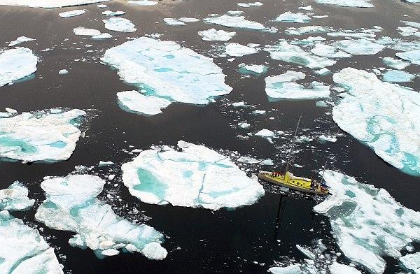
In the past 72 hours S/Y NANUQ had to go through a complex struggle with thick and dense ice, before finally getting out of the block yesterday. In the last Skipper’s report, sent late last night, the boat was proceeding at about 5 knots towards north-east in order to reach another research area. In an e.mail sent via Iridium, Prof. Gallinelli wrote: “We have finished with the pack ice, due to patience and hard work, manoeuvring and pushing NANUQ through ice with densities exceeding 8/10 at times… and a strong boat capable of withstanding continued banging into pieces of ice 10 times her size. (…) We are now rapidly progressing NE to catch up with the time lost in the ice. We expect to make a call at the first accessible mooring, but so far this seems compromised due to most fjords being filled up with compact ice at the moment. The weather outlook is good for the next days and so we are looking forward.” While blocked in the ice, the Skipper needed, from time to time, to verify indications of the reported charts, and also to obtain a more detailed map of the ice formations in the vicinity of the boat. In order to achieve that, the expedition drone was flown repeatedly by Lisa Gallinelli, providing useful images from above. The drone is a FlyToDiscover/GREAL-customized DJI Phantom 4 Pro fitted with additional sensor payloads and a 200 meter nylon hand-operated tether. The UAV is normally used for aerophotogrammetry, thermal or NDVI surveys, or, like in this case, for basic – but valuable – aerial observation.